












8


Disaster Resilience and Reconstruction Systems Engineering Laboratory (Spatial Information group)
Professor / TAKAHASHI Kazuyoshi
Research Assistant / SAKATA Kenta
Technical Staff / NAKAMURA Takeshi
Technical Staff / NAKAMURA Takeshi
- Explore the city through the eyes of birds(satellite images, drones, etc.)
- Utilization of Geospatial Information for Disaster Prevention and Mitigation
- Solving social issues using remote sensing technology
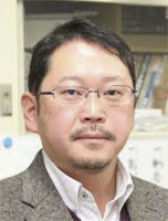
Professor / TAKAHASHI Kazuyoshi
I am conducting research to utilize spatial information collected by remote sensing technology in various fields. Professors consult with us not only in seminars but also on a regular basis about our research and provide us with accurate and detailed advice.
Research Content
We are engaged in research to utilize spatial information acquired by sensors mounted on drones and satellites for disaster prevention and mitigation in various fields. We are also actively engaged in research using the latest technologies, such as LiDAR devices and deep learning, which are recently used for automatic driving and other applications. Currently, I am working on the development of a method for measuring snow accumulation on roads using vehicle-mounted LiDAR and a method for monitoring the growth of agricultural crops using drone-mounted LiDAR.
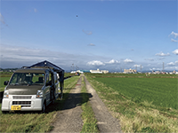
A drone equipped with a laser scanner is used to measure paddy rice.
A Day in the Lab
In the laboratory, students conduct research at their own pace and report on their progress in weekly or bi-weekly seminars. Research is conducted in a well-planned manner, from data acquisition to examination of analysis methods. Students can also practice their presentation skills by using their own materials to give progress reports in the seminar. Since there is a lot of fieldwork, such as measurements by drone and acquisition of snow distribution, students help each other’s research as they go along.
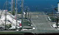
This is an in-vehicle LIDAR developed in our laboratory.
Thesis Subjects
- (M)Advancement of a Vertical Distribution Estimation Model for Rice Canopy Point Clouds Acquired by Drone LiDAR
- (M)Snow-Cover Area Estimation beneath Cloud Cover in Mountainous Regions Using High-Frequency Optical Satellite Imagery
- (B)Investigation of Snowbank Height Measurement on Road Shoulders Using Monocular Depth Estimation AI
The number of
PhD Graduates
1
Major employers of Graduates
- PASCO
- Yokogawa Bridge Corp.
- NTT Infranet
- East Nippon Expressway(NEXCO East Japan)
- East Japan Railway(JR East)
- Sada Construction
- Chiyoda Engineering Consultans
- Niigata Prefecture
- TOBISIMA CORPORATION
- NEXCO Engineering Niigata
